
Salt tectonics of the Eastern Carpathian Bend Zone — from the folded galleries of the Slănic Prahova salt mine to the Mânzălești diapir, the largest rock-salt outcrop in Europe.
The Eastern Carpathian Bend Zone is one of the classic salt-tectonic provinces of Europe, where salt has shaped the fold-and-thrust belt and its hydrocarbon system. This two-day course takes participants from the spectacular folded galleries of a show salt mine to Europe's largest rock-salt outcrop, reading salt deformation across a range of scales.
On the first day we descend into the Slănic Prahova salt mine, whose cleaned and lit galleries expose metre-scale isoclinal folds in the mid-Miocene halite. On the second we examine the Mânzălești diapir — a low-angle sheared, decapitated salt body with spectacular salt-karst geomorphology and some of the fastest present-day salt uplift rates measured anywhere.
Throughout, we connect what is seen in the field to the structural style of the Bend Zone, to the salt's role in the petroleum system, and to salt research more broadly. Instruction is led by structural geologists whose published research defined the salt structures of the region.
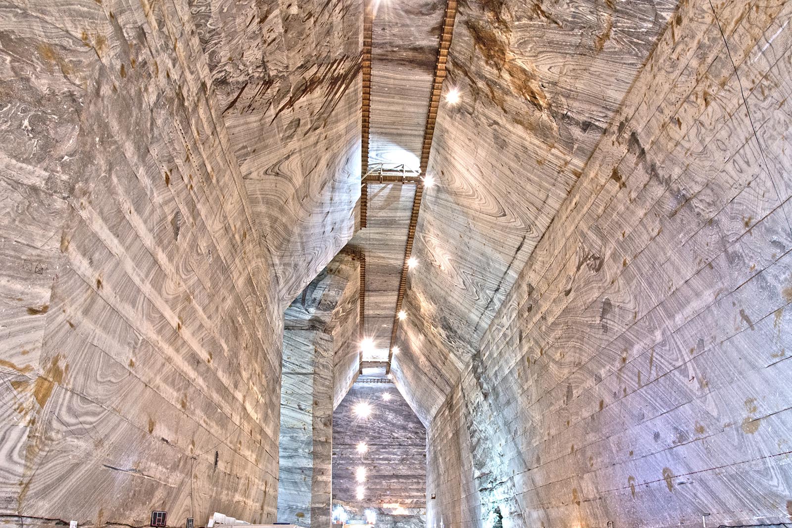
Travelling towards our base at Berca, with a stop near Brebu en route, the day centres on the Slănic Prahova salt mine in the Diapir Fold Zone of the Bend Zone. Closed to extraction but open to visitors — with salt also exposed at surface — its Unirea galleries (mined 1943–1970, base level ~208 m below surface, ceilings some 60–70 m high) reveal metre-scale isoclinally folded halite in grey, white and black colour bands, with boudinaged anhydrite-rich layers, recording Wallachian-phase shortening. We use the mine to read salt flow and the structure of the Slănic syncline within the Tarcău nappe.
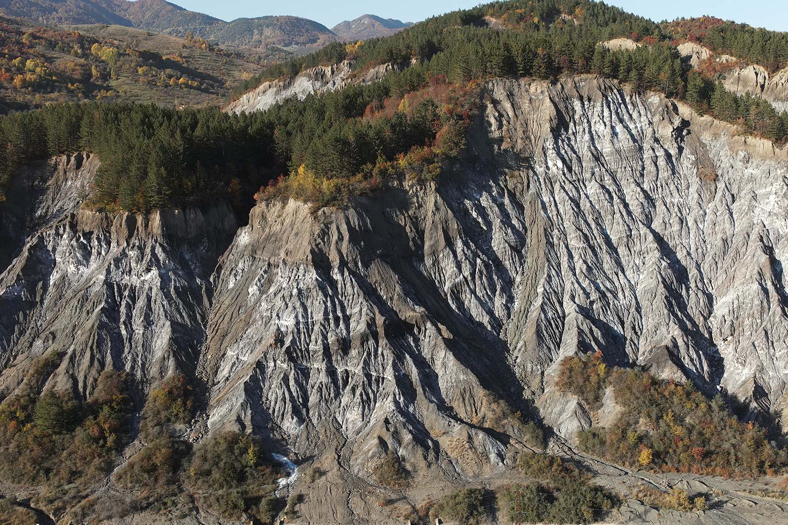
The Mânzălești diapir is the largest rock-salt outcrop in Europe — about 2.7 by 1.3 km at surface, above salt whose base lies at roughly 3,500 m. Unlike the sub-vertical fabric of most Romanian diapirs, it shows a sub-horizontal foliation with isoclinal folds and low-angle shear zones, interpreted as the sheared, decapitated top of a deep salt-cored structure overridden by the advancing Tarcău nappe. We examine its impure, inclusion-rich halite and its spectacular salt-karst geomorphology and dissolution features — it hosts the longest salt cave in Europe — and discuss the remarkably fast present-day uplift of the diapir revealed by radiocarbon dating and satellite (PSInSAR) data.
A background in geology or a related geoscience is recommended; the course suits practising professionals and postgraduate students alike, and no prior experience with salt tectonics is required.
The course involves a visit to the Slănic Prahova show mine (reached by stairs or mine transport, with walking over uneven underground floors) and surface fieldwork over uneven terrain at Mânzălești. A reasonable level of fitness is required; the mine is cool year-round, so warm clothing is advised.